


Voting District 005010, Bannock County, Idaho
About
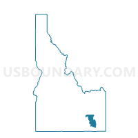
Outline

Summary
| Unique Area Identifier | 563719 |
| Name | Voting District 005010 |
| County | Bannock County |
| State | Idaho |
| Area (square miles) | 1.65 |
| Land Area (square miles) | 1.65 |
| Water Area (square miles) | 0.00 |
| % of Land Area | 99.95 |
| % of Water Area | 0.05 |
| Latitude of the Internal Point | 42.90357330 |
| Longtitude of the Internal Point | -112.49265670 |
Maps


Graphs
Select a template below for downloading or customizing gragh for Voting District 005010, Bannock County, Idaho


Neighbors
Neighoring Voting District (by Name) Neighboring Voting District on the Map
- Voting District 005008, Bannock County, ID
- Voting District 005009, Bannock County, ID
- Voting District 005011, Bannock County, ID
- Voting District 005012, Bannock County, ID
- Voting District 005014, Bannock County, ID
- Voting District 005051, Bannock County, ID
- Voting District 005054, Bannock County, ID
- Voting District 077006, Power County, ID
Top 10 Neighboring County Subdivision (by Population) Neighboring County Subdivision on the Map
- Pocatello CCD, Bannock County, ID (71,772)
- South Bannock CCD, Bannock County, ID (5,286)
- Arbon CCD, Power County, ID (181)
Top 10 Neighboring Place (by Population) Neighboring Place on the Map
Top 10 Neighboring Unified School District (by Population) Neighboring Unified School District on the Map
Top 10 Neighboring State Legislative District Lower Chamber (by Population) Neighboring State Legislative District Lower Chamber on the Map
- State House District 29, ID (44,248)
- State House District 27, ID (38,757)
- State House District 30, ID (38,591)
Top 10 Neighboring State Legislative District Upper Chamber (by Population) Neighboring State Legislative District Upper Chamber on the Map
- State Senate District 29, ID (44,248)
- State Senate District 27, ID (38,757)
- State Senate District 30, ID (38,591)
Top 10 Neighboring 111th Congressional District (by Population) Neighboring 111th Congressional District on the Map
Top 10 Neighboring Census Tract (by Population) Neighboring Census Tract on the Map
- Census Tract 3, Bannock County, ID (9,052)
- Census Tract 4, Bannock County, ID (5,510)
- Census Tract 15, Bannock County, ID (5,181)
- Census Tract 16.01, Bannock County, ID (2,716)
- Census Tract 9601, Power County, ID (1,651)
- Census Tract 9818, Bannock County, ID (278)